
Tracing an Eagan Street Address
Begin an Eagan street directory search with the complete address when possible. Dakota County Property Information accepts an address or PIN, then links the selected parcel to property, tax, building, plat, and printable-detail material. Record the current owner, owner mailing address, municipality, legal description, and PIN separately. The PIN is the county parcel identifier. The situs address is the physical location. Those two fields make a more reliable bridge than a street name alone, especially where a deed uses a lot, block, subdivision, or older land description.
Ownership and occupancy are different questions. A property result may show a current owner and where assessment correspondence is sent, but the mailing address can belong to an agent, business, or another state. Use the county record as an ownership lead, then compare a recorded instrument, lawful voter route, permit date, or historical listing only when each source fits the time period.
- Search the address in Dakota County Property Information and select the matching parcel. Save its PIN, situs address, legal description, and municipality.
- Open the map context and click nearby parcels one at a time. Address and parcel-label layers help keep similar house numbers on the right Eagan street.
- Use the legal description or PIN to check the recorder path. A deed can connect a current owner to a prior transfer, but it is not proof of a household roster.
- For a known person and address, use the Minnesota registration-status tool as a match check. A street-wide result is not produced by that form.
- When the question is historical, compare the verified Eagan telephone-book holdings and county maps with the parcel. No official Eagan criss-cross directory run was confirmed, so do not assume one exists.
Keep a search log with the address spelling, street direction, suffix, selected parcel, date, and portal. That makes a no-result useful when a later search turns up a different street form or coverage gap.
Eagan Street Directory Search Fields
The county property portal starts with two real search choices, not a countywide people list. Enter a PIN with or without dashes, or use a full address, a house number, or part of a street name. After a match is selected, its panels divide the result into property, tax, and building information. That division matters because the name and mailing data belong in the property panel, while homestead and assessments appear with taxes and building facts appear elsewhere.
| County field or control | Type | When used | Result or note |
|---|---|---|---|
| Parcel ID / PIN | Text | Use instead of an address | Dashes are optional; returns the matching parcel. |
| Address | Text | Use instead of a PIN | Full or partial house number and street name produce a selection list. |
| Property Information | Panel | After a parcel is chosen | Owner, owner address, municipality, tax description, districts, PDF, plat links. |
| Tax Information | Panel | After a parcel is chosen | Current and prior tax, special assessments, and homestead status. |
| Building Information | Panel | After a parcel is chosen | Year built, bedrooms, bathrooms, and square footage. |
The Dakota County Property Information help page shows the address and PIN workflow used for an Eagan street search.
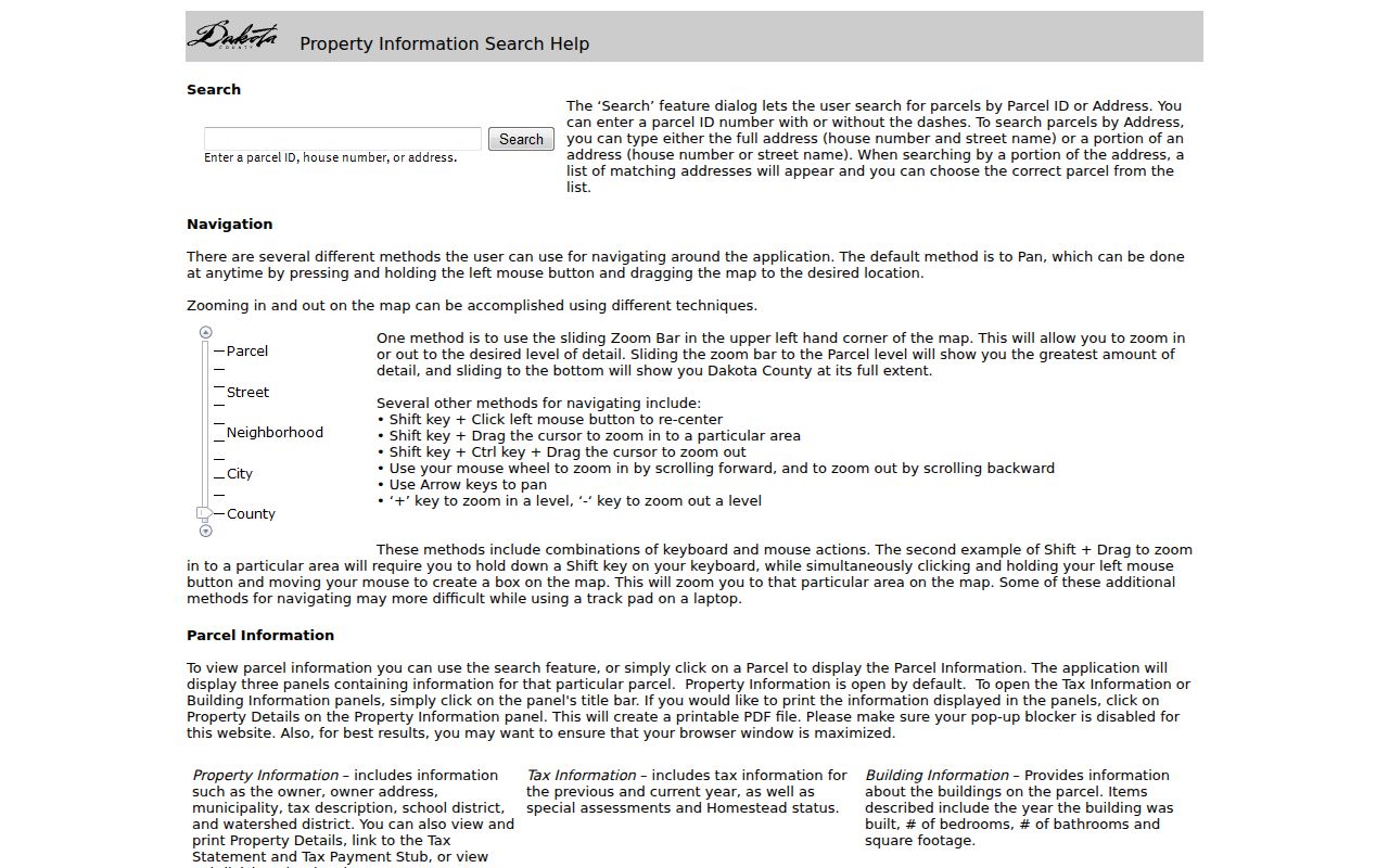
Use the matching list before reading the details, particularly when a street has similar numbers, direction words, or unit information. The research did not document a live countywide owner-name result, so the public address and PIN entries are the reliable starting fields.
Eagan Streets in County GIS
The GIS layer set gives the Eagan street directory its map context. After selecting a parcel, pan and zoom along the street, then click the adjacent parcel rather than assuming a map shape equals one household. Available layers include addresses, PIN labels, tax parcels, subdivisions, lot dimensions, PLS and section context, Torrens property, recent improved or vacant sales, and foreclosure layers labeled by year from 2019 through 2026. Condominiums and multi-unit parcels need extra care because one visible shape can relate to more than one unit.
The service supports map queries, ordering, distinct values, pagination, and distance parameters, with a parcel-layer maximum record count of 10,000. Those technical capabilities describe the map service, not a promise of a resident export. The county specifically says its map is not a legally recorded map or survey. Use it to orient an address, find the next parcel, and collect a parcel-level record trail.
The Dakota County GIS service displays the public layer structure behind this Eagan street view.
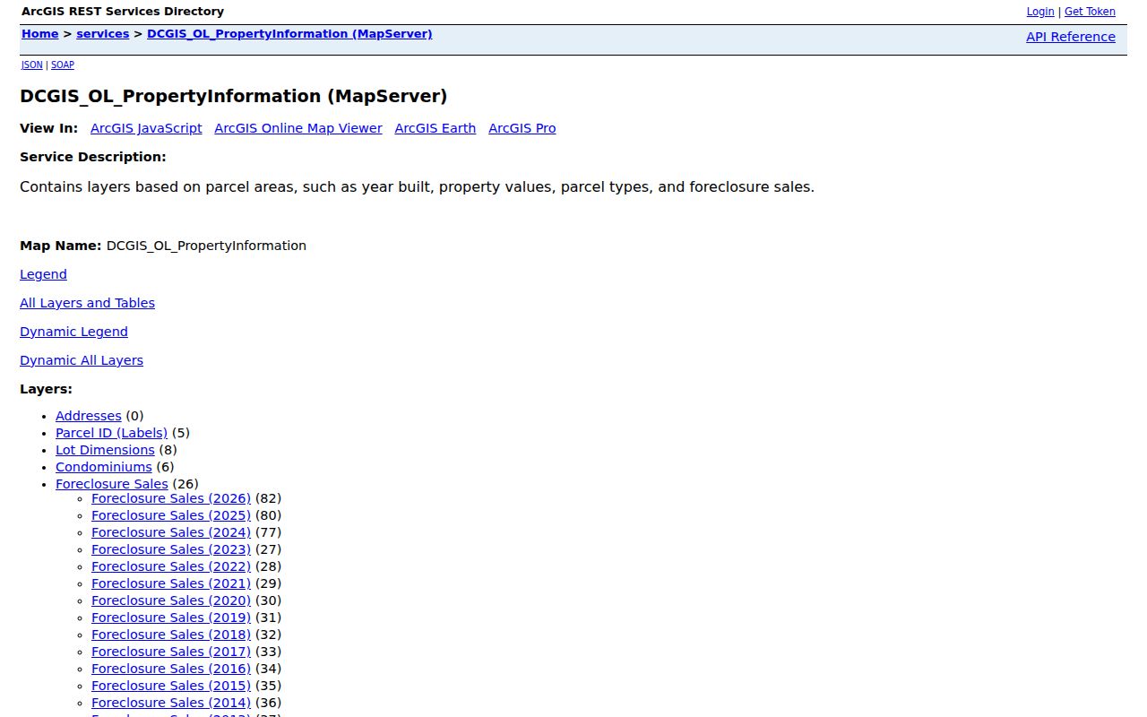
Parcel labels and subdivisions can also help reconcile a current Eagan street address with a deed whose text uses lot and block language.
Note: A GIS click identifies a parcel context, while a recorded plat or survey controls the formal land description.
Eagan Records by Street Address
An Eagan street directory brings together several custodians, each with a narrower job. The parcel record anchors the present location. GIS shows parcel geometry and adjacent addresses. The recorder preserves instruments that affect title. The City permit portal adds address-linked activity. Election records have their own lawful-access rules. Treat each result as evidence of the field it actually reports, rather than merging every name into one claim about who lives at an address.
| Address record | Keeper | What it can show | Access route |
|---|---|---|---|
| Parcel details | Dakota County Property Taxation & Records | Owner, mailing address, PIN, legal and tax description, districts, tax and building facts | Free property portal or county public terminals |
| GIS parcel layers | Dakota County GIS | Parcel shape, address and PIN labels, subdivisions, dimensions, sales, foreclosure layers | Free viewer, not survey evidence |
| Recorded instruments | Dakota County Property Taxation & Records / Recorder | Grantor, grantee, date, number, instrument and legal description | RecordEASE login and paid search or office route |
| Permits and cases | City of Eagan | Address-linked permit, application, inspection, or available document information | OnLama search or a city request |
| Voter records | Minnesota and Dakota County elections offices | Limited public voter information only through the statutory route | Address match or restricted list request |
| Telephone books and maps | MNHS and Dakota County Historical Society | Past name, phone, street, plat, or map context | Verified holdings and research access |
A PIN and legal description are the strongest connectors between the property panel and the deed index. A street name is still useful, but abbreviations, directional prefixes, units, and older descriptions can make it too broad on its own.
Eagan Street Permit Records
The City of Eagan's OnLama portal provides a second address index for an Eagan street directory search. Basic search accepts a street address, licensed contractor name, license holder name, reference code, or permit, license, or case number. Results may be viewed, printed, watched, exported as CSV up to 200 records, or opened for available downloads. Logged-in advanced filters add description keywords, Council District, permit, license, or planning types, and application-date ranges.
Construction permit data is advertised from 1995 forward. A permit can help date work, an application, an inspection, or a project, but it does not establish a sale or identify every person connected to the property. No live result row was inspected in the research, so column labels beyond the portal's stated capabilities should be verified during a specific search.
For a public city record not returned by the portal, ask the City Clerk, Building, or Planning staff with the address, case type, and date range. City Code is online through Municodes, though the printed Clerk copy is the official version and online amendments can post later.
Eagan Street Deed Trails
A recorded deed follows land, not a household. In RecordEASE, start with the current parcel's legal description and search for the current owner as grantee, the person or entity receiving the instrument. Capture the recording date and number, grantor, instrument type, legal description, and image availability. Then search the prior grantor as an earlier grantee for the same tract. A grantor is the party transferring an interest. Repeat the role reversal only after the legal description still fits the parcel.
Dakota County RecordEASE requires login and has paid access. The county's stated online abstract description begins July 8, 1993. Documents in some book, page, and document-number ranges are digitized, but the research does not support a claim that every older name or image is fully indexed. Search both Abstract and Torrens paths when the property status calls for it. For a pre-index gap, ask for a tract page or card, a book and page, a document number, or copy options.
The RecordEASE recorder interface is the source for this Eagan street directory deed route and its current index-status notices.
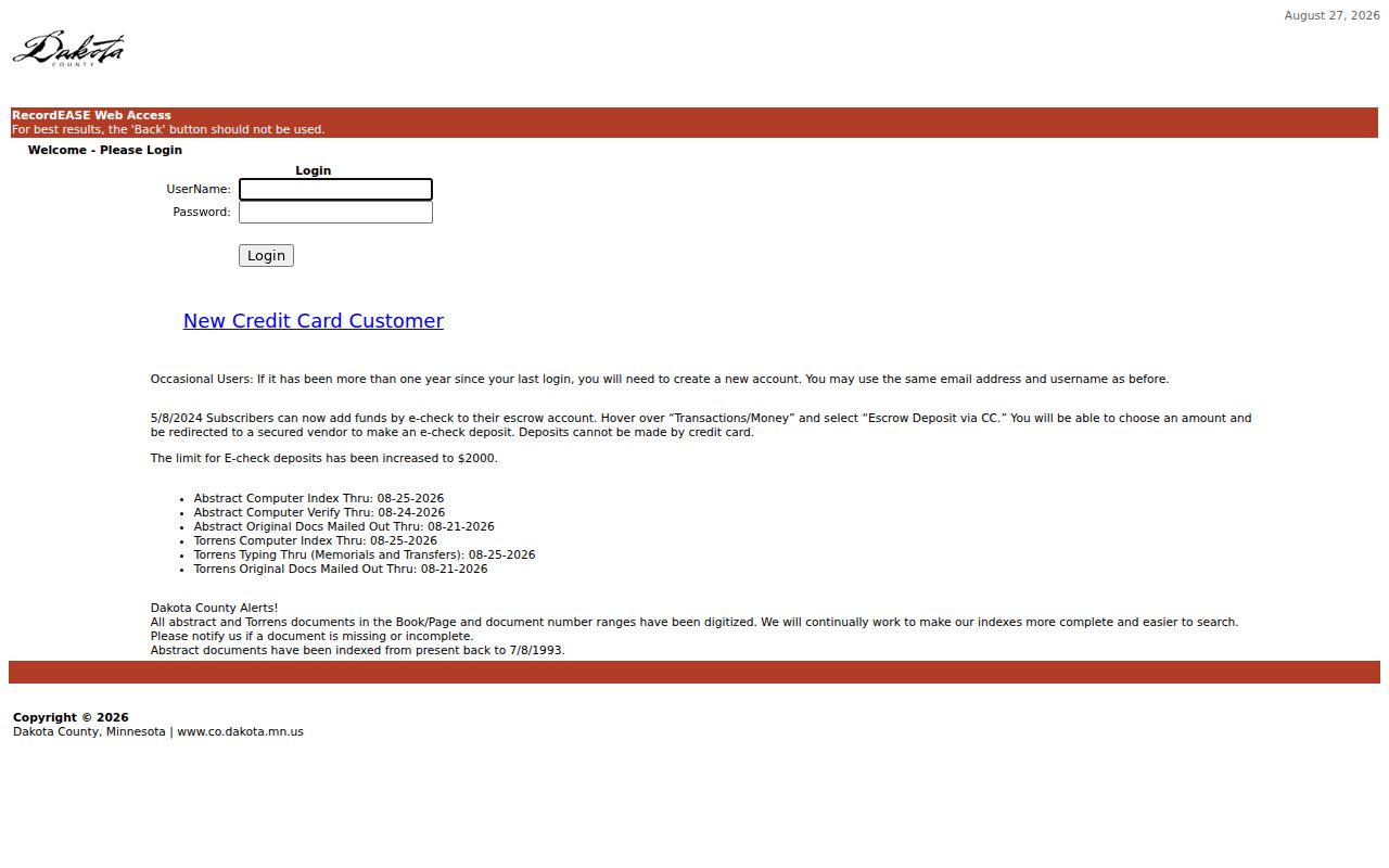
Save the exact name spelling, legal description, date range, and index status for a negative search. An empty result may reflect a spelling, tract, or coverage problem rather than no transfer.
Eagan Street Voter Limits
Minnesota Voter Status Lookup is a known-person, known-address match. It can begin in ZIP-code or county mode, then requires first and last name, city or township, house number, street, and a unit when applicable. The result confirms registration status and offers next-step information. It is updated nightly, while local processing can take up to 14 days and then appears the day after processing.
The basic form does not create a street-wide roster. Minnesota's public information list has separate rules under Minn. Stat. §201.091. Inspection requires identification and a written statement limiting use to elections, political activities, or law enforcement. A lawful request may cover a city, county, district, ward, precinct, or a walking list sorted by street. The listed product costs $30 for those local geographies and $46 statewide, carries certification requirements, and may not be republished online as a searchable list.
Public fields can include name, residence address, birth year, voting history, districts, and a voter-supplied phone number. They do not include full birth dates or government identification numbers. Safety withholding and Safe at Home protections also limit what should be exposed.
Eagan Street Address Language
Street labels change meaning across record systems. The county address layer records a building number, directional prefix or type, street name, street type, suffix direction, and unit information. The current parcel also has a 17-character PIN and a legal description. A deed or plat can instead refer to a subdivision, lot and block, or metes and bounds. If a modern search fails, bridge the address through the PIN, plat, tract card, parcel map, and subdivision name rather than guessing that a street was renamed.
- Parcel
- A defined piece of land tracked by the county, commonly through a PIN and legal description.
- Situs address
- The physical location of the parcel. It is distinct from the address used for tax correspondence.
- Plat
- A recorded map that can relate a street address to a subdivision, lot, and block.
- Criss-cross directory
- An address-organized directory. No official Eagan run was verified, so use documented telephone-book holdings instead of assuming this format.
Eagan was incorporated in 1974 after a township era, so older material may use township, county, subdivision, rural-route, post-office, or city terms for the same general area. No official Eagan street-renumbering list, E911 bridge, or annexation-address bridge was located. Confirm a suspected change with City Engineering, City GIS, or historical plats.
Eagan Street Directory History
The historical layer of an Eagan street directory is best documented as telephone books, not a confirmed Polk or reverse-directory series. MNHS's Dakota County finding aid identifies Eagan material from 1964 through 2011 in print, fiche, and yellow-pages-only forms. The run has meaningful gaps and format changes: 1965 is not listed, 1974-75 have yellow-only plus print material, 1981 has fiche, 1988-90 include duplicate or fiche references, and 2008-11 include yellow-only items. A missing year is therefore not proof that a household was absent.
Pair a historical entry with the county's map sequence from 1916 through 1971, DCHS plat ownership maps from 1879 forward, and the current PIN. DCHS also has newspaper microfilm back to the 1850s and census materials from 1849 through 1940. Those sources can clarify a road, boundary, property, or household context without turning a historical listing into proof of present residence.
For the collection-level details, use the Eagan city directory page rather than treating a telephone listing as a complete modern address record.
Note: Preserve the volume year, format, street spelling, and page reference whenever an older listing is used.
Limits of Eagan Street Directory
An Eagan street directory can establish a parcel trail, public owner field, recorded land instrument, address-linked permit, or historical listing. It cannot produce a complete list of private occupants, utility customers, delivery recipients, or protected people. A tax mailing address is not a residence finding. Homestead status is an owner-occupancy indicator, not conclusive proof of who is present. Driver and motor-vehicle address data also has separate federal protection under the Driver's Privacy Protection Act.
Lawful use. Use Eagan address records for personal, lawful research and verify a result with its custodian. Do not use any record to stalk, harass, intimidate, or harm another person.
For a record that is not public online, document the custodian, portal, search date, exact address or PIN, street variant, filters, coverage notice, and whether the system reported a nonmatch or only an empty list. That audit trail distinguishes an access limit from a true absence.